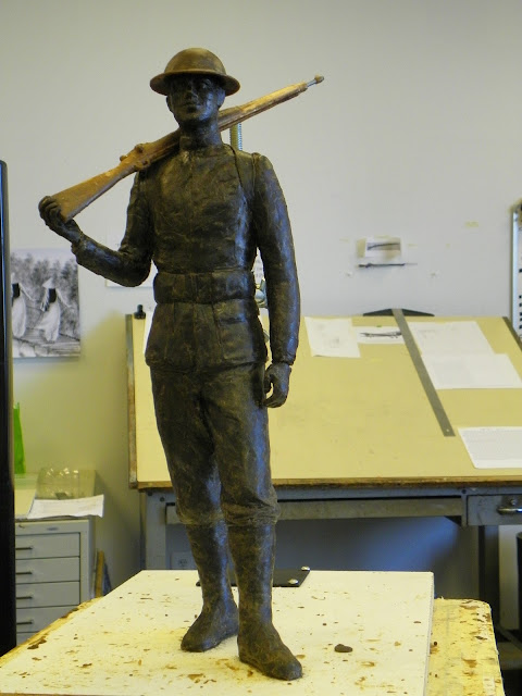
Work continues on the Marine from WWI.
I'm trying to relax him in the right places and tense him in the right places, and it's really difficult, needless to say. There are such subtleties in folds and the underlying structure of a figure in the uniform, that it's hard to get it to look "living." But it's "good training" as the Marines like to say.
Thursday, May 02, 2013
Subscribe to:
Post Comments (Atom)


2 comments:
Incredible, looks great!
Approximately twelve and a half years ago I drove down into what appeared to be a base underneath Oak Hammock Marsh Manitoba Canada (protected wildlife sanctuary), I completely forgot the experience until reading a report on underground Nazi bases 8 months ago (The Omega Files), I then used Google Earth to view Oak Hammock Marsh and the surrounding areas, I found numerous irregularities including: a flying saucer that appears to be broke down in the mud, two saucers with adaptive camo and what appears to be their landing vehicles nearby them, a landing area that appears to be marked with two swastikas and protected by 2 anti-aircraft weapons, a wormhole in a backyard neighboring Oak Hammock Marsh and a large white/silver tank 100 feet North of that wormhole. Since remembering driving down into what appeared to be a base and finding these irregularities using Google Earth I have not stopped making this known, in my opinion anything less would be committing treason against Canada. These images and links are posted on my Facebook account which is open to the public. In my photo album named Possible Nazi base on Canadian soil I have included images taken from previous satellite imaging of Oak Hammock Marsh (Google Earth Pro) so it is possible to see what is normally in those areas.
Link to Possible Nazi base on Canadian soil Facebook photo album.
https://www.facebook.com/media/set/?set=a.631329920225024.1073741834.100000440659439&type=1
Links to Google Earth showing parts of a possible Nazi base on Canadian soil
Landing area marked with 2 swastikas and protected by 2 anti-aircraft weapons, west 400 feet is adaptive camo saucer, distortion around edges of saucer is visible.
http://maps.google.ca/maps?hl=en&ll=50.174163%2C-97.101154&spn=0.000515%2C0.001062&t=h&z=19
Saucer (possibly broken down), 2 mud tracks from it trying to take off or skimming the ground to avoid radar detection, 400 feet NNE of that is the landing vehicle for the saucer.
http://maps.google.ca/maps?hl=en&ll=50.225015%2C-97.139643&spn=0.000865%2C0.002296&t=h&z=19
Wormhole in backyard of property and large white/silver tank 100 feet North of that.
http://maps.google.ca/maps?hl=en&ll=50.151111%2C-97.101787&spn=0.000741%2C0.001725&t=h&z=19
Saucer landing vehicle, saucer NW of that at end of mud track with adaptive camo, distortion can be seen around edges of saucer.
https://maps.google.ca/maps?hl=en&ll=50.152524%2C-97.108787&spn=0.000956%2C0.002124&t=h&z=18
Technology used to create projection top on base, when I drove down into the base 12.5 years earlier the projection was turned off.
https://maps.google.ca/maps?hl=en&ll=50.174576%2C-97.128424&spn=0.001053%2C0.001725&t=h&z=19
Statement from the former Canadian Minister of National Defense.
http://www.youtube.com/watch?v=FYSwomqKDqQ
News report on chem trails.
http://www.youtube.com/watch?v=mY16kEzIdHY
Nazi bell uncovered (Nazi bell used by the Nazis to create wormholes)
https://sites.google.com/site/nazibelluncovered/
Post a Comment